


Our Tourist Destinations – The Seven Sisters and Historic Bengal
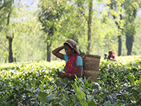 Assam is one of the most important and beautiful state of the north east region. Assam’s capital city Guwahati is known as the gateway of North East. Assam has the total area of 78, 438 sq.kms. It has 23 districts with an overall population of 31.17 million people. Assam is very much rich in culture, ethnic groups, languages/dialacts spoken and literature. This state is the house of many tribes like Bodo, Mishing, Rabha,Tiwa, Kachari, Chutia and so on. It is famous for Assam tea, large and old petroleum resources (the first oil reserves of India were discovered in Assam in the late 19th century), Assam silk and for its rich biodiversity and its successfully conserved the one-horned Indian rhinoceros.
 Meghalaya and its capital Shillong is known as the Scotland of the East is one of the most fascinating states of North East. Meghalaya has the total area of 22, 720 sq. Kms. In the 16th-17th c AD, Meghalaya was ruled by the Khasi, Jayantia, Garo tribes etc; they had very friendly relation with the Ahoms who was ruling in greater Assam then. Through the treaty of Yandaboo in 1826, Assam came under the direct control of the British East India Company and consequently in 1832 & 1835 the Khasi and the Garo territories of Meghalaya also came under the British rule and it continued till Indian independence in 1947.
 The name Manipur itself means the “city of the jewels” is one of the fascinating states of North East. In the year 1891, the region came under the British rule from the kings of Manipur. During the Second World War, Japanese fighting against the allied forces entered Imphal, the capital of Manipur. But finally the Japanese got defeated. After the battle, under the Manipur Constitution Act of 1947 with the king of Manipur as its chief executive, a democratic government was formed in Manipur. It was only in the year 1956 when Manipur comes under the administration of Indian government and in 1972, Manipur had got the recognition as a full fledged state.
 Mizoram became the 23rd state of India on 20th of February, 1987. The Mizos (the inhabitants of Mizoram) are believed to have migrated from the Singlung region near the Yalung river in China. Mizos means the people who live in the hills and the entire state houses some colourful tribes like Hmar, Lushei, Paite, Lai, Mara etc. Mizoram is beautiful with its series of hills, peaks, plains, rivers and lakes. The highest peak in Mizoram is 2210 meters tall Blue Mountain which is located in south east of Mizoram. Palek lake is the largest lake of Mizoram having an area of 30 hecters. Some of the famous tourist spots of Mizoram is its capital city Aizal which is full of scenic beauty, Dampa sanctuary full of different variety of bamboos. The hill town of Sampai with the lovely blooming “Reddedron”. However, Lake Palak and Temdil lake is another two picturesque lakes in Mizoram.
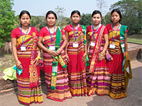
 Tripura is a small part of the North Eastern states with 10,491 sq.kms area, it is the third smallest state of India. It was ruled independently by the kings of Tripura before but in 1949,15th October , Tripura became a part of India through Tripura Merger Agreement. Tripura formerly known as Kirat has a history of 2500 years old. The state of Tripura was formed in 21st January, 1972. The main industry in Tripura is agriculture. Rice and other variety of crops are grown here. Tripura is famous for rubber production as well. However, handloom and handicraft and extensive bamboo and cane work is another small scale industry in Tripura. 80% of the total population of Tripura are Hindu Bengalis and rest are consisting of tribes like Kokborok, Jamatia, Riyang, Naitia etc. The palaces constructed by Kings of Tripura are the main tourist attraction there.
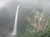
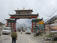 Arunachal Pradesh itself means the land of the dawn lit mountains, it is again known as the orchid state of India. The history of Arunachal is manifold. The name of the region is mentioned in many of the Hindu texts such as Kalika Purana, Mahabharata etc. Arunachal Pradesh became a state of India on 20 February 1987 has 83,743 square kilometre area. Arunachal is a heaven of Northeast. Most of Arunachal Pradesh is covered by the Himalayas. However, parts of Lohit, Changlang and Tirap are covered by the Patkai hills. Kangto, Nyegi Kangsang, the main Gorichen peak and the Eastern Gorichen peak are some of the highest peaks in this region of the Himalayas. The land is mostly mountainous with the Himalayan ranges running north south. These divide the state into five river valleys: the Kameng, the Subansiri, the Siang, the Lohit and the Tirap. All these are fed by snow from the Himalayas and countless rivers and rivulets.
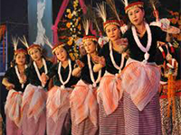
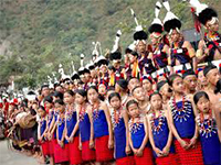 Nagaland, one of the most important states of North Eastern part of India is cradled between Myanmar and three other Indian states. Nagaland was established on 1 December 1963 to be the 16th state of the Indian UnionTopographically, it is a hilly region and the highest peak is Saramati at 3841 meters. The total area of the state is about 16, 527 sq.kms with a population of about 1.9 million. The Nagas are of Mongoloid stock speaking Tibeto- Burmese group of languages. Nagaland has sixteen major tribes such as Angami, Ao, Sema, Lotha, Jakisang, Rengma, Zeliang, Imchunger, Sangtam, Chang, Konyak, Phom, Thankhol, Rongmi etc and many more sub tribes.
News and Events :
Please check your short code, no records available.
About us :
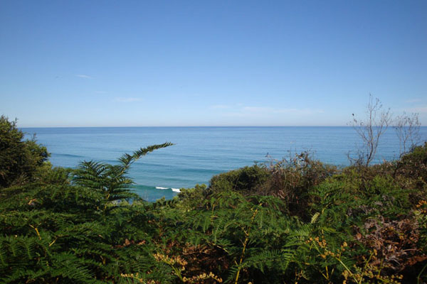
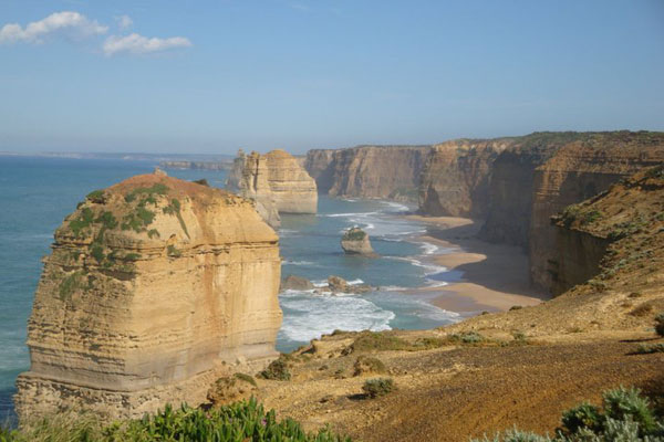
Geography of the land, the mighty river Brahmaputra, its forests, flora & fauna, existed much before men inhabited this land of nature and cosmic beauty.